WELCOME TO GDS LATAM GROUP!
GEODESIGN
FOR DEVELOPMENT
AND SUSTAINABILITY
Spanish

ABOUT

Using Geodesign as a Collaborative platform for developing and improving urban human communities and rural villages at sustainable environments by taking care of nature in all stages.

Geodesign

The deep and integral consideration of site characteristics (environment, geography and anthropic), define the path towards a sustainable design, with proposals of low negative impact and collateral community benefits, towards whole prosperity and social-individual well-being.
VIEW MORE.

Development

Development is the phase that comes after Designing and Planning where you create scenarios for guiding the sustainable development of city growth, buildings, and infrastructures required for servicing the future needs of human activities. This phase is usually undertaken by Developers, Builders and in general companies that are awarded the task to build and develop. These companies or organizations are basically equipped with engineering means to develop roads, residential communities, industrial parks, schools, hospitals, commercial centers and recreational facilities. This phase is more concerned with the present and immediate future and being in charge of delivering the products conceived at the designing and planning phase.
VIEW MORE.

Sustainability

Sustainability is one the newest degree subjects that attempts to bridge social science with civic engineering and environmental science with the technology of the future. When we hear the word “sustainability”, we tend to think of renewable fuel sources, reducing carbon emissions, protecting environments and a way of keeping the delicate ecosystems of our planet in balance. In short, sustainability looks to protect our natural environment, human and ecological health, while driving innovation and not compromising our way of life.
VIEW MORE.

CITIZENS PARTICIPATION

The fundamental aspects that characterize Geodesign and Geoplanning are the procedures themselves, through which the planning and building proposals are generated and developed. From this perspective, the processes are the focus of the collaboration and the purpose of GeoGeodesign, to be able to generate plans that adapt the ordering of the anthropic activities to the capacity and characteristics of the geographical environment that sustain it, but also whose form of occupation and building in said territory, synthesizes most of the aspirations of the community that inhabits them.
VIEW MORE.

Services

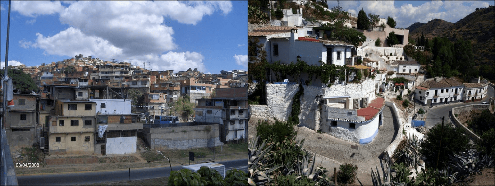
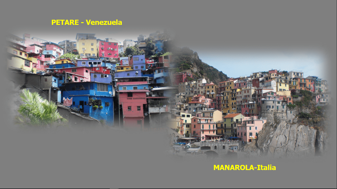
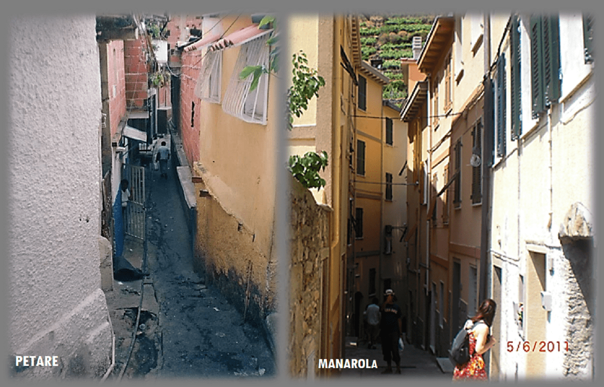
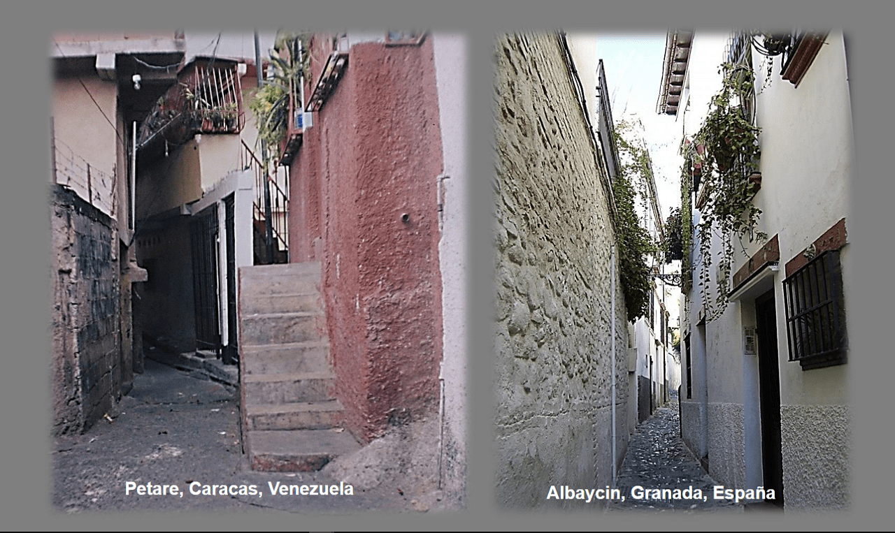
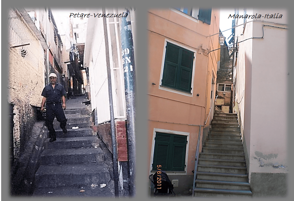
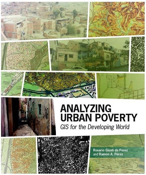
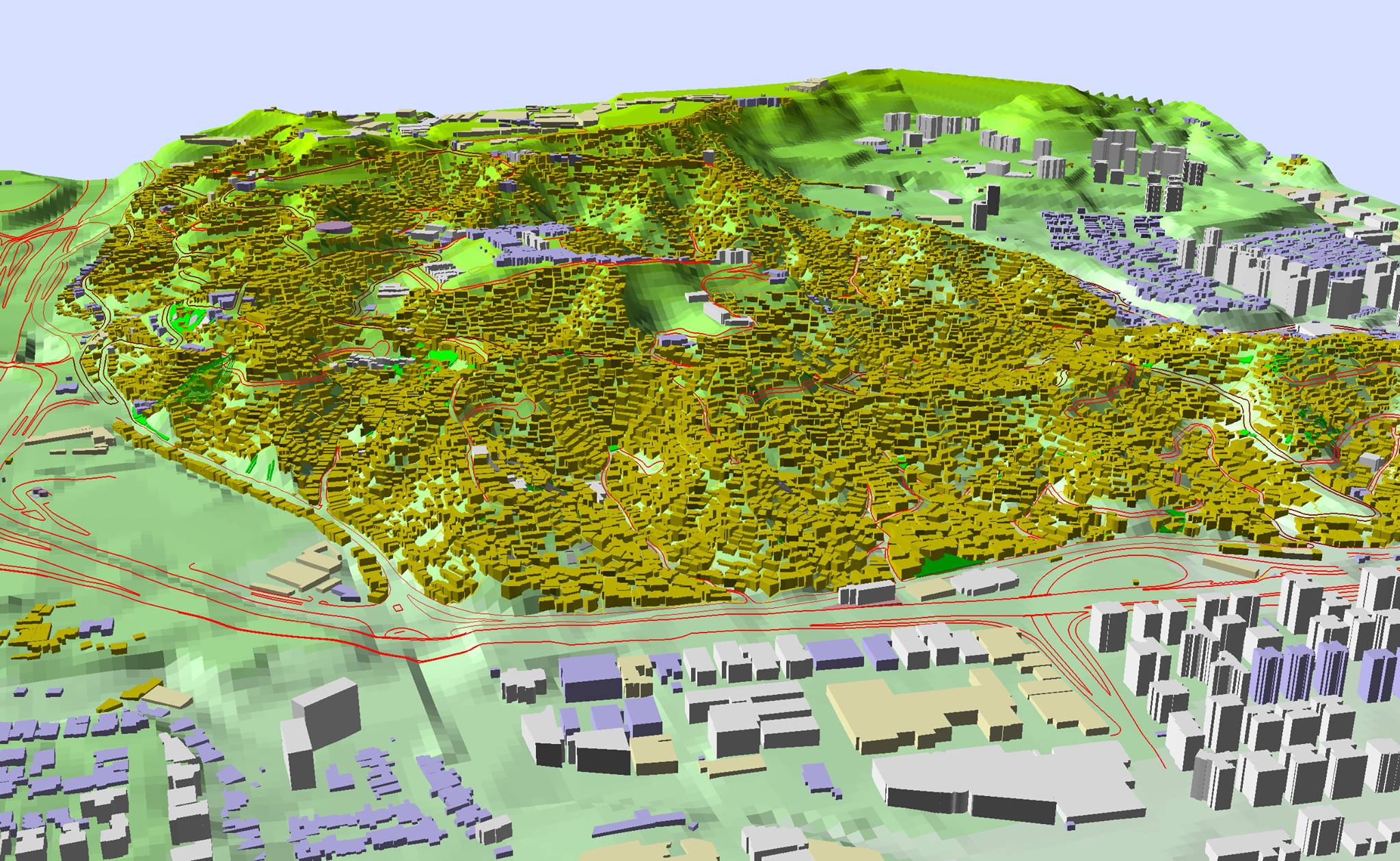
Learn about Planning efforts and GIS Projects developed by members of the GDS Latam Group for Improving Urban Shelters at Poor Urban Environments and developing new concepts for Sustainable and better Quality of Life at isolated Rural Villages.
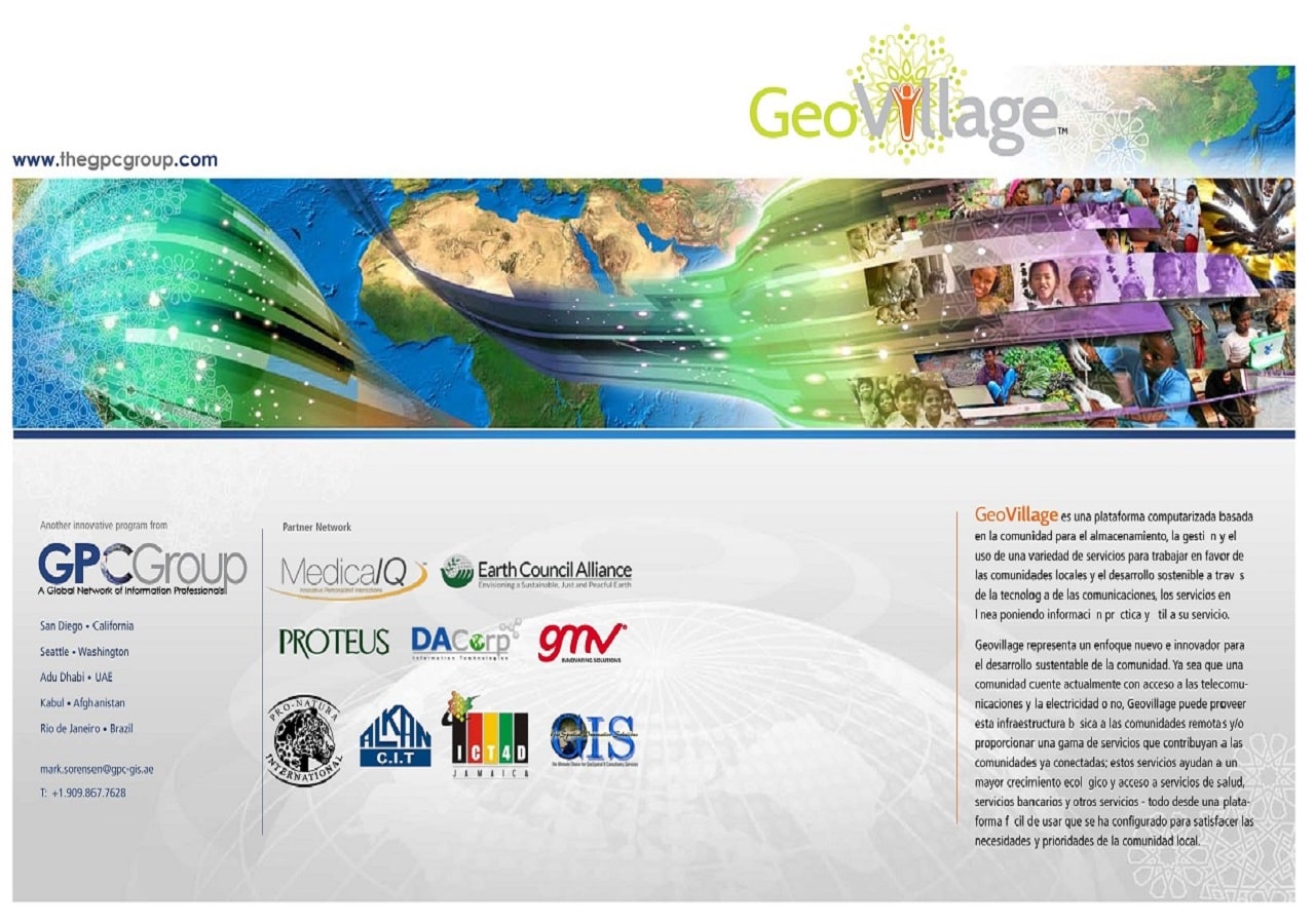


GEOVILLAGE

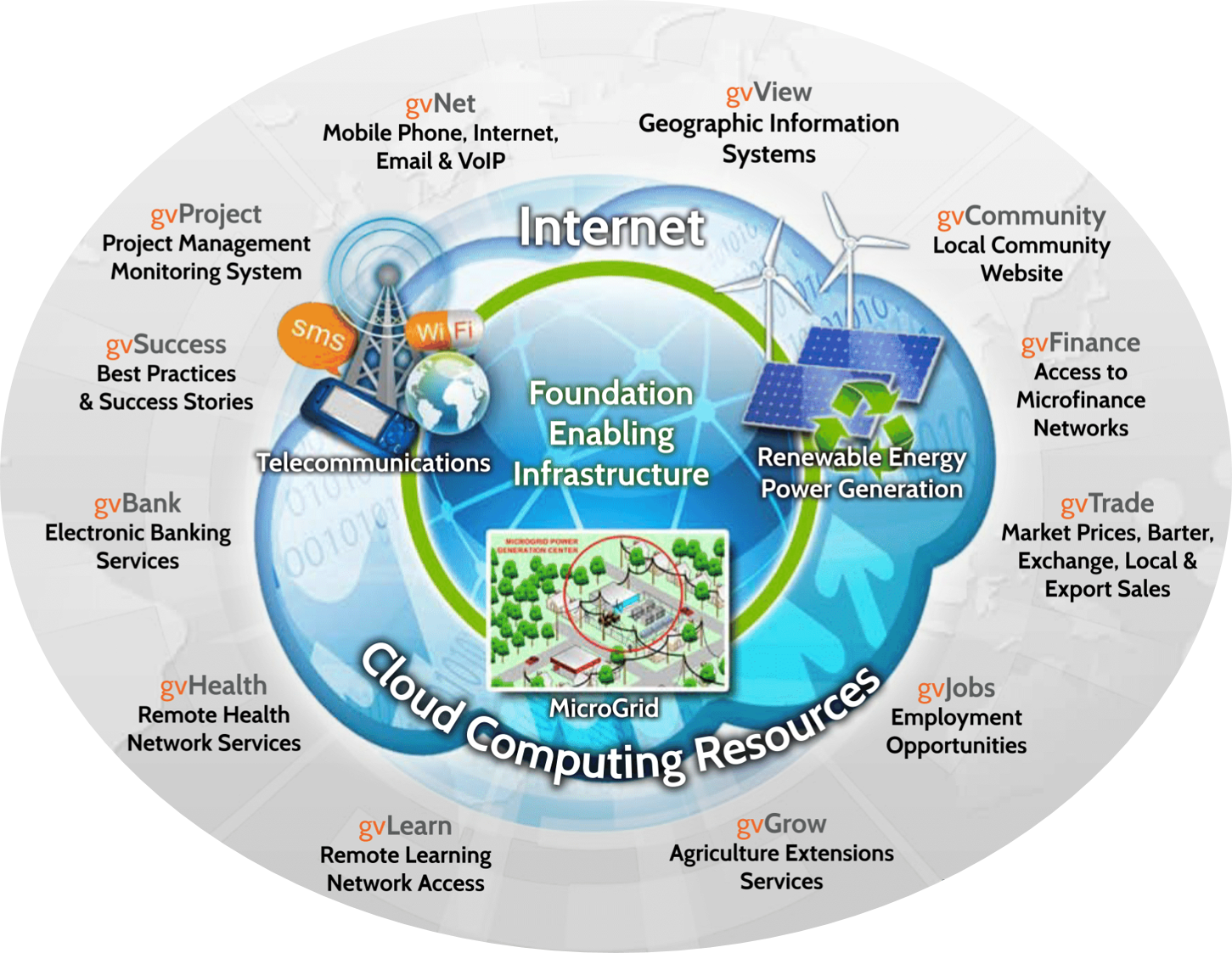
is a community-based computerized platform for storing, managing and using a variety of services that put practical and useful information, communications technology and online services to work on behalf of local communities and sustainable development.

GeoVillage represents a new and innovative approach to sustainable community development. Whether a community currently has telecommunications and access to reliable electricity.

GeoVillage can supply this foundation infrastructure to remote communities, and/or provide a range of services that contribute to connected communities, growing and green economic opportunities, and convenient access to health, banking and other services - all from within an easy to use platform that is configured to address local community needs and priorities.


portfolio

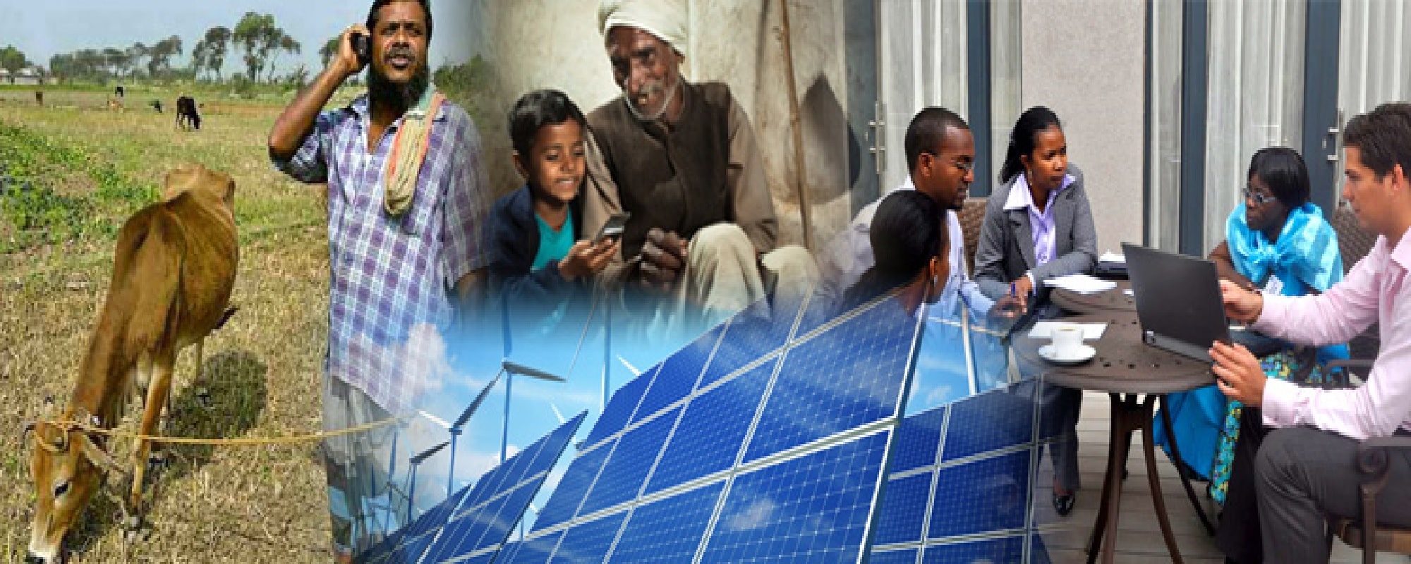
Advances in recent years in mobile telecommunications, low-cost computing, internet, cloud computing and other technologies has resulted in the evolution of the concept of Information and Communications Technology for Development (ICT4D), whereby these technologies are being used in developing countries.

There are many examples from around the world of ICT4D being applied to real-world challenges and opportunities, from SMS-based financial transactions and banking via mobile phones, to access to current market prices of agricultural products for farmers, to access to micro-finance markets for would-be 3rd world entrepreneurs.

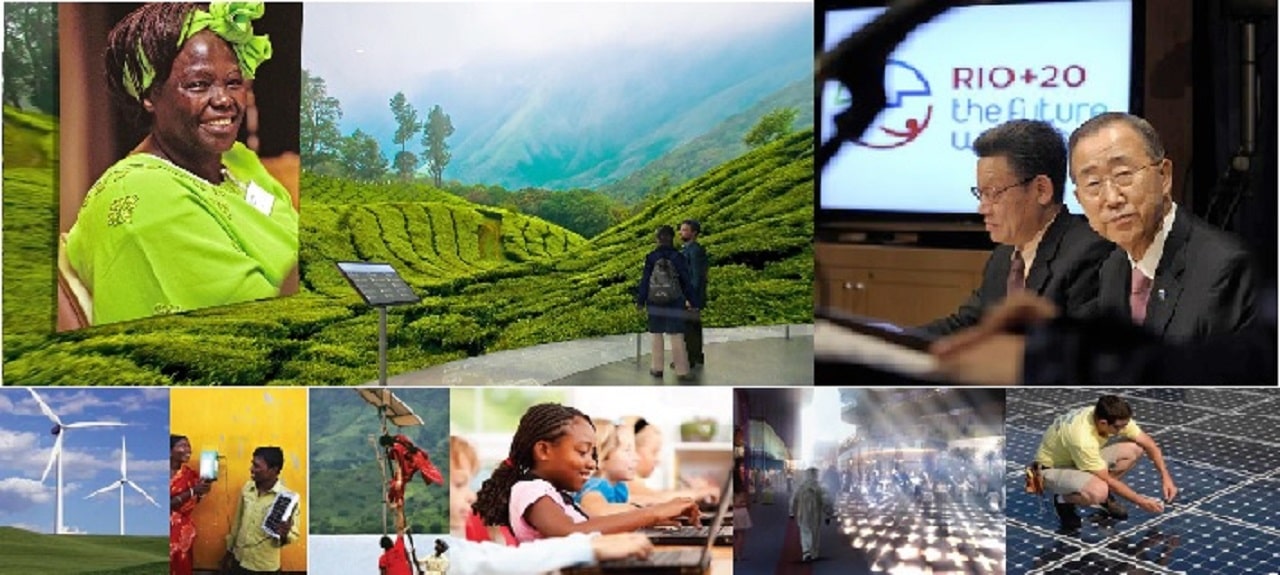
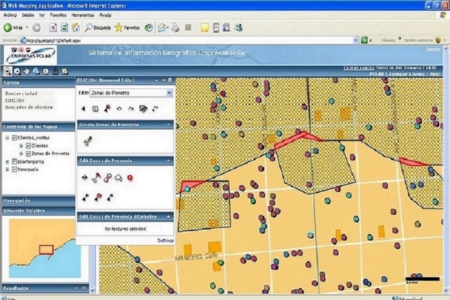
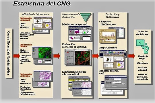
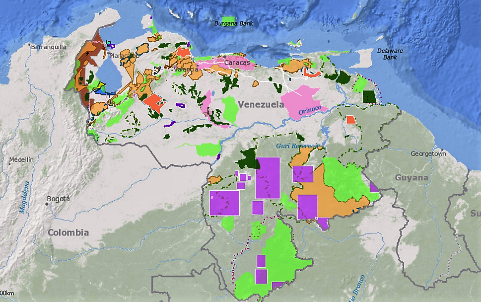
In parallel there has also been a recognition of the application of geographic information systems (GIS) technology in support of development issues (poverty mapping, emergency planning and response, economic development, delivery of humanitarian relief and many other areas) and Spatial Data Infrastructure (SDI) as a valid platform for sharing information across government organizations for increased efficiency, transparency, more effective coordination of foreign aid, and other advantages.

While all of these technologies and examples are being applied successfully in many parts of the world, there is a need for the development of locally-based and focused infrastructure and content that can be configured in an integrated framework supporting sustainable and resilient local development at the village scale.


gvCommunity

The GPC Group has developed a concept for such a framework under the name of GeoVillage–Community Information Infrastructure.


This framework combines ICT4D, GIS, SDI and related technologies, applications and content in a form that can support many aspects of local community development that responds both to local needs as well as the needs of the international donor community to support better project formulation, management, monitoring and evaluation.

A foundation of low-cost mobile telephony, electrification, internet connectivity, community nodes and use of cloud computing support the local perspective, and as well can be chained together to support regional and national matters and macro-assessment.

The GeoVillage concept can be developed in a step-wise, incremental manner that is focused around local issues and priorities, and grown over time. With this approach, it is possible to put ICT, GIS and SDI to work for local communities, while also building the regional and national infrastructure that is needed for developing countries to maximize their natural and societal resources, build strong economies, protect natural and social heritage, and support sustainable and equitable development in ways that can make a fundamental difference for the future.


The Geovillage Brochure is available at this download link.

The Geovillage Concept Presentation is available at this download link.


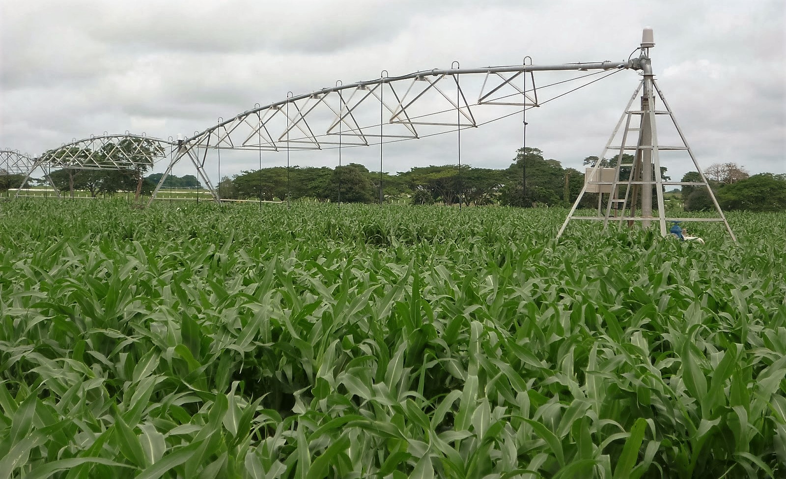
  • Projects for the Urban and Rural Environment
  • Projects for New Communities and Housing Programs
  • Systems for Emergency and Public Security


GEOURBANIZE

GeoUrbanize Concept: Approach to provide poor communities with GIS Locally&Cloud based information infrastructure for supporting Sustainable and Resilient Urban Improvement Plans.

The GeoUrbanize Concept is a methodology to improve the poor urban settlements where communities try to live occupying areas nearby of cities (Be they called Squatter, Slums, Suburban, shanty towns, Peri-Urban or marginal urban areas) so they can have access to jobs, schools, health, transportation and other services located in nearby urbanized areas.

GeoUrbanized Concept acts as framework for the planning, development, operation and support of a GIS information infrastructure organized to provide communities with proposals and enough locally-based geographical information to improve and urbanize their settlements for a sustainable and resilient community development.

The Geourbanize Concept is directly related to improve and diversify the usually scarce or inexistent infrastructure and facilities found in poor urban communities of Latin America, suburban America and poor communities anywhere in the World.

This phenomena is basically an urban one, since you find very poor quarters and neighborhoods located adjacent to the city, but with minimal infrastructure and services, and in developing countries usually limited to shanty houses and shelters where to sleep. GeoUrbanize is a method for urbanizing these marginal urban spaces wherever they are located, and transform them into livable quarters connected and interrelated to the rest of the city they depend upon.

GeoUrbanize comprises several technical and organizational parts that fit together to use information, communications technology and GIS for developing useful information for local communities. In this case it centers its development process in putting as much information in the hands of urban dwellers through the use of smart phones. The mobile phone becomes then the situational room for all the members of poor communities, where they can daily check their nearest urban services, that might be itinerary and can be provided in diverse dates and locations. For example the use of small buses to provide Library’s or schooling and health services on the road. All information can be accessed at My Phone, where anyone can see also information about My Health, My Education, My Recreational and Cultural events programed to serve My Community.

GeoUrbanize is focused in the improvement implementation of urban spaces, since efforts are concentrated in providing urban settlements, as soon as possible, with public spaces by building small squares, meeting places, small parks and green open spaces. Above all there is an effort to improve the quality of the streets and walkways which are linked and function as a network of open spaces and nodes that provide the community with a connected set of facilities. In this way the residents find most of their needs being solved at walking distances, perceiving that improvements are permanent and so are their community ties.

The strategy then consists in preparing plans for improving the housing, education, production, exchange, protection and recreational facilities all within the settlement. Plans are facilitated by building up an information infrastructure about the geography and location of all community facilities. In this sense the Geographical Information Systems acts as a backbone to create a platform for delivering information in real time to all the neighbors and members of the community.

This process is cyclical and spiral, allowing citizens to audit and participate in the follow up, supervision and progress of the building process, by using the smart phone with free applications like ArcGis Explorer, Collector and Survey 123 to place comments and opinions or denounce security incidents that will immediately be known by the rest of the community. In that way the Planners and Public Officials can apply corrective measures to accelerate, modify or attend the issues aroused by the community.

The strategy then consists in preparing plans for improving the housing, education, production, exchange, protection and recreational facilities all within the settlement. These plans are facilitated by building up an information infrastructure about their geography and location of all community facilities. In this sense the Geographical Information Systems act as a backbone to create a platform to deliver such information in real time to the neighbors and members of the community.

This process is a cyclical and spiral one, allowing citizens to audit and participate in the following and supervision of the building progress, by using the smart phone with applications like ArcGis Explorer, Collector and Survey 123 to place comments and opinions or denounce security incidents that will immediately be known by the rest of the community. In that way also the Planners and Public Officials can take corrective measures to accelerate, modify or attend the issues aroused by the community.

The Planners and Public Agencies can also use GIS tools to follow up and control the development of improvements in geographical form. Each Project, its building Company, and the Entity in charge of supervising the building process, can visualize in a Dash Board the progress and proper timing for developing the planned improvements.

In this sense, the main objective of The GeoUrbanize Concept is to facilitate and continuously support members of the community with information about all of its needs and actual situation. This allows residents to make better decisions for the settlement and also become aware and conscious about their geography, and how it relates with living a sustainable life.


The following graphic summarizes the flow of activities proposed by The GeoUrbanize Concept to develop sustainable and resilient smart communities.


Once they reach this level of understanding is when residents become GeoCitizens.


The GeoUrbanize Concept Story Maps is available at this link.

The GeoUrbanize Concept Document is available at this link.


Portfolio

Our portfolio is the best way to show our work, you can see here a big range of our work.
Check them all and you will find what you are looking for.

img02

Petare

A City Within the City

View More
img02

Corpoelec

Development of a system to predict future urban growth and electric consumption for the Maracaibo’s Metropolitan Region.

View more
SIG Polar

Empresas Polar

Development of a country wide solution for client location, territory planning, sales force distribution, and float routing for products distribution.

View more
img02

Conoco Phillips

Development of a GIS for Environmental Monitoring System at the Golf of Paria, where mayor interventions for Gas Extraction and Production was planned out of sea with floating extraction platforms.

View more
img02

Municipality of Chacao

Consulting, training and implementation process for Web publishing of several GIS Maps of the Municipality of Chacao.

View more
img02

Metropolitan Municipality

Consulting process for developing a GIS (based on ESRI’s technology) for the administration and implementation of the water supply network at the City of Maracay.

View more
img02

Hidrocentro

Development of a Prototype Model for an Urban Metropolitan Information System (SIUM).

View more
img02

Autoridad Nacional del Ambiente de Panamá (ANAM)

A General Comprehensive Territorial and Environmental Plan (PIGOT) for the country of Panama.

View more
img02

Comisión de Estudios para el Desarrollo
de la Cuenca del Río Guayas (CEDEGE)

Development of a GIS for a Comprehensive Environmental and Social Management Plan for the Rio Guayas Watershed and the Santa Elena Peninsula.

View more


More Projects

0

Countries

0

Clients

6

Team

0

Awards

Our Team

Here are key stakeholders focused on building our community.

Ramón Pérez

RAMÓN PÉREZ

CEO & GDS LATAM GROUP FOUNDER
View Profile
Ramón Pérez Rodriíguez graduated as an architect in the Faculty of Architecture, Universidad de Los Andes, Mérida, Venezuela and went to the Urban Design Program, Graduate School of Fine Arts at the University of Pennsylvania to obtain a Master’s Degree in Architecture 1970 and a Master’s Degree in City Planning (1971) and also was awarded a Diploma in Urban and Regional Planning at the Poliyechnic University of Scezecin, Poland in 1974. During several years he was professor and Director of the Center for Urban and Regional Studies at the Faculty of Architecture, and founder of Postgraduate Diploma for Computing in Architecture at the University of Zulia. He was awarded the Diploma "Orden Carlos Raúl Villanueva" at the College of Architects in 1994 for his research activities in Urban and Regional Planning.
Since 1997 Ramón Pérez has been President of Grupo Esri de Venezuela.


Rosario Giusti de Pérez

ROSARIO GIUSTI DE PÉREZ

DIRECTOR OF URBAN STUDIES
Rosario Giusti graduated as an architect in the Faculty of Architecture, Zulia University and went to the Urban Design Program of the Graduate School of Fine Arts of the University of Pennsylvania to obtain a Master’s Degree in Architecture and a Master’s Degree in City Planning (1972). During several years she was a professor at the Faculty of Architecture of Zulia University, teaching at urban workshops, being part of research studies and during three years in charge of the Graduate Course Program. For her research activities she was awarded with the prize “Carlos Raul Villanueva”, 1998.
Since year 1972 she was part of the team of A.T. Sistemas, a Consulting Office of Architecture and Urban Design and since 1997 she became the Director for Urban Studies in Grupo ESRI de Venezuela.


Edgar Díaz

EDGAR DÍAZ

GENERAL MANAGER
View Profile
Edgar is a professional with over 15 years experience in Technology Geographic Information Systems (GIS) and remote sensing. This experience includes a sound knowledge of conceptualization, design, development and implementation of GIS, data management, systems integration and digital cartographic generation, especially related to environmental issues, oil and service networks. Experience in managing ArcGIS, and other products developed by the Environmental System Research Institute (ESRI). Ability to learn new technologies. Experience working groups overseeing and conducting projects. Ability to work independently as well as part of a team. ESRI instructor demonstrating great ability to share knowledge through teaching training processes.


Elizabeth

ELIZABETH ZARZALEJO

SENIOR CONSULTANT
View Profile
Extensive experience in project development in various areas of geography. Twenty-six (26) years as a professor at the Central University of Venezuela, School of Geography. Retired Professor UCV, category: Aggregated. Consultant and Coach applying the experience to leverage, reorganize and negotiate projects requiring advance in a timely manner, with quality and precision, in order to strengthen the responsiveness and decision making at different levels of the organization. Managerial experience in implementing economic and environmental partner’s projects related to field operations activities, thematic maps for social indicators and proposals for the collection of data. Collection of geo-demographic data, implementation and supervision of enumerators and logistics for the preparation of material (censuses and surveys) and Public Land Registry Service. Ability to communicate, ability to solve technical problems and mediator of conflicts in organizations. Writing technical reports and management of MS Office.


Ricardo Cuberos

RICARDO CUBEROS

SENIOR CONSULTANT
View Profile
Expert consultant in urban and regional planning, and geographic information systems for land register, environmental studies and oil industry. Wide expertise in design and civil works of buildings (residential, culture, commerce, industry and banking), also dwelling complexes and urban design. Tenured professor at University of Zulia (LUZ), in academic labor since 1984, undergraduate and graduate teacher for several higher education institutions, research and extension consultant for public and private sector, with wide university management experience. Co-author of many papers, lectures and chapters in peer-reviewed books. Co-director of scientific journals, and usual peer reviewer of scientist journals and meetings. Computer applied guest speaker in architectural and urban design, at EEUU, Belgium, Poland, Spain, Brazil, Chile, Colombia and Venezuela. Lead researcher, co-researcher and advisor in 11 accredited scientific studies.


Carlos Machado

CARLOS MACHADO

SENIOR CONSULTANT
View Profile
Informatics Engineer with a Master in Business Management mention Social Responsibility, with more than 19 years of experience in the design, development and implementation of Geographic Information Systems (GIS) in the areas of territorial planning, conservation and management of natural resources, systems cadastral, oil, gas, mining, digital mapping, remote sensing, integration of spatial databases, geographic web applications and customization of control panels. Establishing as a professional mission to provide intelligent data to help improve organizational workflows and turn them into success stories, using ESRI's ArcGIS platform.


Ada Asprino

ADA ASPRINO SOTO

RESOURCES MANAGER
View Profile
Ada has experience supervizing at Wall Street English centers in Venezuela (17 centers and the Corporate Service Departament). Guarantee service quality according to standard operating procedures. Lead the service team. Ensure quality of students learning. Manage service statistics accomplishment. Review class schedules according to international alignments (class forecast). Elaborate center visit reports. Forecast staffing needs, according to centers growth. Manage staff recruitment, training, evaluations, motivation and professional development. Analyze centers action plans, and provide feedback. Manage educational material stock levels and purchases. Facilitate internal revenue through quality service delivery.


Miguel Cano

MIGUEL CANO

SENIOR CONSULTANT
View Profile
Degree in Geography with 44 years of career in different areas of geography and 54 years in total in the field of cartography, standing out in the creation of Basic Cartography and the Urban and Regional Planning, both activities, as much as in field activities as in cabinet activities, in the Directorate of National Mapping (Today IGVSB) and specialized companies in the industry (SAPROATE and TRANARG, CA), coordinating and supervising large groups of professionals and workers; teaching in the areas of the subjects Urban Geography Seminar and Urban Geography in the School of Geography at the UCV (Head (E) Urban Geography Cathedra); in the area of regional and urban planning such as State Plans Planning (Coordinator of the Territorial Planning Nueva Esparta State) and Sectorial Plans Enabling Physical Zones of neighborhoods (Project Coordinator Maturin, state Monagas for CONAVI) and Local Urban Planning (Puerto Nutrias and Condominium Structures poor neighborhoods of Caracas). Actively involved in spatial demographic studies for inputs such plans. Geographic Information Systems (GIS). Sub-study coordinator for the Establishment of Condominium Structures Zones Barrios (Petare and La Vega) Did a consulting work for the United Nations Population Fund (UNFPA) for evaluation of the 2001 Population Census of Venezuela and Cartographic Archives of Geographic and Statistical Information System (SIGE) INE, Venezuela and International Consultant for Cadastral Survey of the metropolitan area of Quito, Ecuador for Venezuela TX Group. Served as coordinator of mapping projects, Cadastral, Urban and Regional Planning in enterprises, SA Project and Aerial Survey and Earth (SAPROLATE), TRANARG CONSULTANTS, CA and Studies and Projects in GEOGEMAPE, CA. Vice-President of the Venezuelan Geographer's Association, President of the Venezuelan Chapter of the Union of Geodesy and Geophysics and Active in Geographic terms and Land Use Committees in the Pan American Institute of Geography and History PAIGH. Member of the Geography and Cartography National Commissions, National Section Venezuela, and served as official liaison between the Pan American Institute of Geography, History (PAIGH) and the UN on Geographic Names. Also received awards for the work made, national and international awards.


Elia Villalobos

ELIA VILLALOBOS

CONSULTANT
View Profile
Versed in Geographic Information Systems (GIS) and remote sensing, with a little more than 20 years of experience including knowledge base, design, development and implementation of GIS projects, management and control database, systems integration and development of digital mapping. Wide domain in ArcGIS, and other products developed by ESRI, Inc. Adaptability to new technological developments. Working with multidisciplinary teams in the area of GIS and / or relating to civil engineering work. Instructor products ArcGIS platform. Collaborator, and part of teams: Urbanism, Cadastral, Urban and Regional Impacts, among others. Extensive knowledge in the frequently used programs: Platform ArcGIS: ArcGIS for Desktop, ArcGIS for Server, ArcGIS Online, ArcGIS Mobile, ENVI, ArcIMS, 3D Analyst, Spatial Analyst, ArcView, Windows, Microsoft Office: Excel, Power Point, Word , Access, Outlook, OneNote, Movie Maker, Photo Editor, Paintbrush, Corel Draw, Front Page 7 Zip, Winzip, ArcInfo, Dbase for Win, ArcCAD, Free Hands, Acrobat Reader, Adobe Photoshop CS 9 Epanet 2.10, Lulo Win , AutoCAD, Internet, OneDrive, SkyDrive, Dropbox, Google Drive, Translators, Scanners, Printers, Photocopiers, Digital Cameras, GPS. ArcSDE, Oracle, Gmail, Hotmail among other handlers post.


Elia Villalobos

AUREA RODRIGUEZ

CONSULTANT
View Profile
Undergraduate degree in Computer Sciences at Universidad Central de Venezuela with a Master degree in Business Administration from Universidad Catolica Andres Bello. Have 32 years of experience in the use of Geographic Information Systems (GIS), and development of digital image processing applications. Specifically, in the design, development and implementation of GIS projects in the oil, environmental and service area. Currently developing strategies for teaching GIS technology. I have worked in projects of Website design, development of marketing strategies.


Henry Pereira

HENRY PEREIRA

SENIOR CONSULTANT
View Profile
University Professional with a Masters in Public Management, with 29 years of experience in the area of ​Computer Science and Computing in Windows, Unix and Linux Servers. Computing Center, Oracle Database, SQLServer, PostgresSQL and MySQL. Helpdesk Team Supervisor, Technical Support, Ricovery Disaster, LAN Networks, WIFI Networks. Geographic Information Systems (GIS), Spatial Databases, Tools developed by Esri.


Gloria Martinez

GLORIA MARTINEZ

SENIOR CONSULTANT
View Profile
Master Planner in Integrated Systems (III). Specialist in Organization and promotion of Self-Sustained/ Self Managed populations through Integral Development (Social, Political and Economic) Education: Philosophy. Complex Methodology. Trialectic Integralism. Professional Coaching. Theology and others. Facilitator in the formation of a Course in Miracles (Master). Key qualifications: Expertise in Comprehensive Land Registry (Cadastre) Integrated Planning Advisor. Intersectoral Implementation and Integrative Model Executioner (Integral Land Registry or Cadastre). Introduction and Instruction of this model at international level (Costa Rica, Mexico) In Venezuela, National,Regional, Municipal and Local level. Integrated Investigative Institute (III): Member of the Board; Managing and Executive Director; General Coordinator of Fieldwork (Master Contestants) in Research / Master of Social Development III / UC); Principal Coordinator for Administrative Aspects in the Master Program of Social and Education Development (III / UC). Route Superintendent (Capital District and following states: Miranda, Guarico, Apure and Amazonas.) Founding and Organizational Member of the Foundation for the Integral Development of self organized populations: Case Chiguará (Merida), Case Cantarrana (Sucre) Case Canoabo (Carabobo), Case Macarao and Case Curucay (Macarao / Caracas). Case Cumbo (Edo. Miranda). PRO Cumana (Cumana-Sucre). Private Organizations: Foundation for the Integral Development of Adult (FUNDEA). Organization for Integral Development of Women and the Family (ODIM). Integrated Systems C.A. (SISINCA) .- Organization for Integral Development of the Self (ODISER -f.p). Chief Counselor: National Health System (MINSAS); Organic Integrated Development (Zulia); Integrated Strategic Development (Monagas) Plan; MBI project (Mayor Mario Briceño Iragorry / Aragua.); Macarao Project (Caracas); DATA DEMI project Instructional and Management Boards: Operational Intelligence Management and Efficiency System Control by (Integrated Investigative Institute III). Concept and Design for the total integrational model: Sinab; Sistall; Sisret and SISCAM. Recipient of multiple awards as facilitator - Collaborator and Speaker.


Flor Mendez

FLOR MENDEZ

SENIOR CONSULTANT
View Profile
Graduated as an architect in the Faculty of Architecture, Zulia University, Maracaibo, Venezuela (1969) and went to the National Engineering University, Lima, Perú to obtain a Master Degree in Urban Planning (1972). In 1980 obtained a Master Degree from the Urban and Regional Planning Department, University of Iowa, Iowa City, USA. During several years she was a professor at the Faculty of Architecture of Zulia University working as an Urban and Regional Planner in the design and creation of data bases for 4 projects of Geographic Information System (GIS). Since 1995 she has been working for ESRI Group of Venezuela designing and creating data bases for 5 projects of Geographic Information System (GIS).


Contact Us

If you have some Questions or need Help! Please Contact Us!